
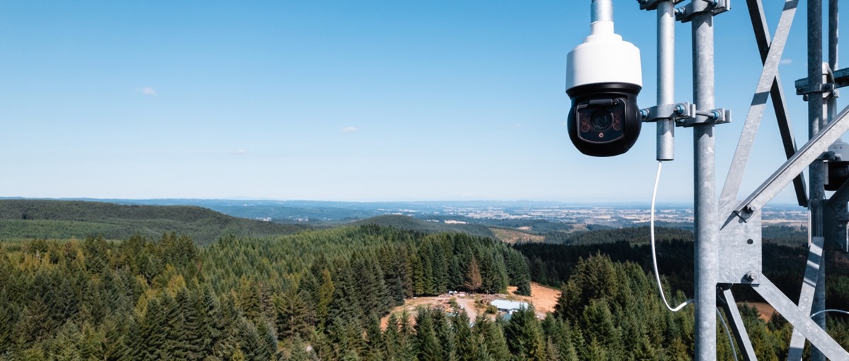
On June 15, 2025, lightning started a wildfire in a wooded part of Douglas County, Colorado. Ground crews needed about two hours to reach the area on foot. A Pano AI camera station positioned above the landscape detected the smoke first. According to Xcel Energy, the utility that had deployed the equipment, county emergency officials received coordinates and dispatched a helicopter. The aircraft reached the fire within 30 minutes of the alert and began dropping water within 45 minutes. The utility bought the monitoring service, but the county emergency team used the location to act. Xcel fire response account
That division of roles is the commercial idea behind Pano AI. The company is not merely selling a camera or a smoke-classification model. It is selling a monitored detection network whose verified alerts can move from the organization financing coverage to the public agencies authorized to respond.
A utility is not buying only a camera
Each elevated camera station rotates through a full scan every minute. AI looks for smoke in the images, and analysts in Pano’s monitoring center review potential detections. Once an alert is confirmed, responders receive the location and imagery. Views from more than one station can help triangulate the source, so the alert can give dispatchers more than a general report that smoke is visible somewhere on a ridge. Pano solution description Xcel deployment announcement
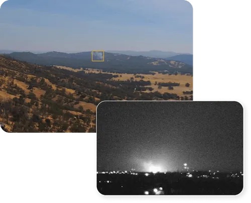
Examples of daytime and nighttime monitoring imagery from Pano product material.
The human review step matters. Wildfire detection has an asymmetric error problem: a missed fire can be catastrophic, while repeated false alarms can exhaust the attention of dispatchers and field teams. Pano combines automated scanning with a staffed monitoring layer before sharing a confirmed alert. The buyer therefore receives software, physical coverage, and an operating service rather than an unreviewed stream of model detections.
The Associated Press reported in May 2026 that the service costs about $50,000 per camera per year, including fire-risk analysis and the continuously staffed monitoring center. That is a reported market reference, not Xcel’s disclosed purchase price. A separate public procurement record provides another commercial signal: the City of Austin’s contract catalog lists an approved ceiling of roughly $1.75 million for a 2023-2028 wildfire-monitoring agreement. A ceiling is not the same as money already spent or vendor revenue already recognized. Associated Press industry report City of Austin contract catalog
One procurement serves two groups
Utilities and fire agencies look at the same smoke plume through different operational lenses. A utility wants to know whether a fire is close to transmission lines, substations, or other assets. An emergency agency needs a location it can use to choose an approach route and decide what resources to send. Pano distributes a verified alert to response partners and says fire departments and other emergency agencies can access local camera stations and the Pano 360 platform without paying for a separate deployment. Pano solution description
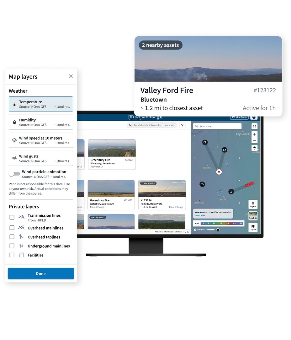
Pano’s official interface illustration. It is not a record of the Douglas County incident.
This arrangement helps resolve a common infrastructure problem. The organization with the budget and a direct asset-protection incentive may not be the organization with authority to dispatch aircraft or crews. If every fire department had to purchase a parallel camera network before receiving an alert, coverage would fragment and response partners could see different information. A utility-funded network can instead make the same verified location available to the agencies that can act on it.
The model does not make the public response free in an economic sense. Utilities and municipal buyers still fund hardware placement, connectivity, monitoring, and analysis. Emergency agencies still pay for their own personnel and response resources. What changes is that the responder does not have to duplicate the detection procurement merely to see the relevant local alert.
Expansion follows infrastructure risk, not administrative symmetry
In May 2026, Xcel said it had installed nine camera stations in northwestern Wisconsin and planned additional sites near power lines in areas with elevated wildfire risk. The stations were not distributed evenly across administrative boundaries. Coverage followed the utility assets and terrain the buyer wanted to protect. The Wisconsin rollout also shows the same customer carrying the operating model into another service territory. It does not prove that every new station will reproduce the Douglas County response time. Xcel deployment announcement
The Douglas County account is valuable because it names the actors and sequence: detection, verified coordinates, dispatch, helicopter arrival, and water drops. It remains one customer-reported event. It cannot establish an average improvement in response time, a reduction in fire damage, or the performance of all stations. The Wisconsin deployment is adoption evidence, while the Colorado event is an example of use. Keeping those claims separate makes the case stronger, not weaker.
The useful operating metric is therefore not simply how many smoke plumes the model detects. Buyers need to know how quickly a candidate alert is verified, whether the coordinates reach a dispatcher before another report, how often alerts are actionable, and whether new stations create meaningful lead time around the infrastructure they cover. Those measures connect the AI workflow to the decision the buyer is funding.
Pano AI’s product boundary is unusually clear. Cameras and models provide continuous observation, analysts convert detections into verified alerts, the platform shares a common operating picture, and emergency agencies decide what to dispatch. The utility pays because earlier, better-located information protects its network and surrounding communities. Fire crews use the service because the alert arrives in a form that can support an operational response.